Did you know that smartphone photos contain hidden location data? The latitude, longitude, time and device details are included in it.
This feature works well at grouping and locating photos after all, but also raises privacy-related issues. There are several ways to try to find the exact coordinates of a photo. This guide will explain four proven methods for extracting latitude and longitude from an image.
What Are Geotagged Photos?
Images that include location data are referred to as geotagged photos. The data is stored in the Exchangeable Image File Format (EXIF). When you take a picture using your smartphone or GPS-enabled camera, latitude, longitude, altitude, and timestamp is automatically saved.
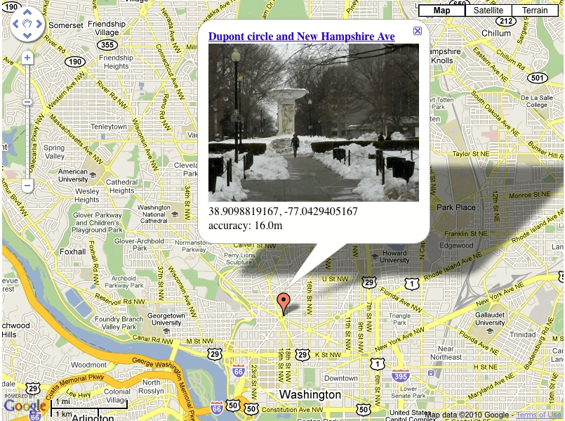
Geotags give users the controls to place, locate, and arrange photos. However, they also have a potential security risk. Others can track the location where the image was taken if they share it over the Internet. Hence, some social media platforms remove EXIF data at the time of uploading.
Extracting the latitude and longitude from an image it requires an EXIF viewer. Let’s explore the best methods to do it.
How to Find Latitude and Longitude from an Image
All digital photos hide their metadata, including the location it was taken. It can be used by photographers, investigators, and travelers for this information. In this section, we will discuss the four methods to extract location data from images rendered on different devices.
Using Built-in Tools
There are many operating systems that come with built-in tools to get location information from photos. These tools are EXIF readers, which means they read EXIF metadata and read the lat and long details inside it. This information can easily be accessed by Windows, Mac, and Linux users without the need for third-party apps. Here’s how to do it on each system.
Windows
In Windows, EXIF metadata is directly viewable within File Explorer on the user’s end. Without additional software, you can check a photo’s GPS coordinates instantly. But if location data is missing, the photo might not have been geotagged.
- Right-click the image file.
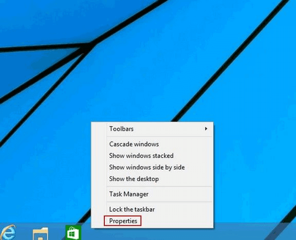
- Select Properties from the menu.
- Go to the Details tab.

- Scroll to the GPS section to see the latitude and longitude.
Mac
Mac users can view image metadata, including GPS coordinates, using Preview or the built-in Photos app. This allows quick access to geotagged data.
- Open the photo in Preview.
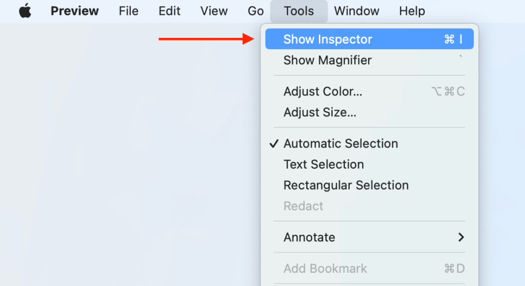
- Click Tools in the top menu.
- Select Show Inspector → Exif tab.
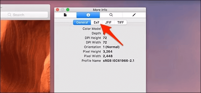
- Find latitude and longitude under the GPS section.
Linux
Linux users can check photo metadata using the Image Viewer or terminal commands. The ExifTool command-line tool provides detailed metadata, including coordinates.
- Install ExifTool.

- Open Terminal.
- Type: ExifTool image.jpg.
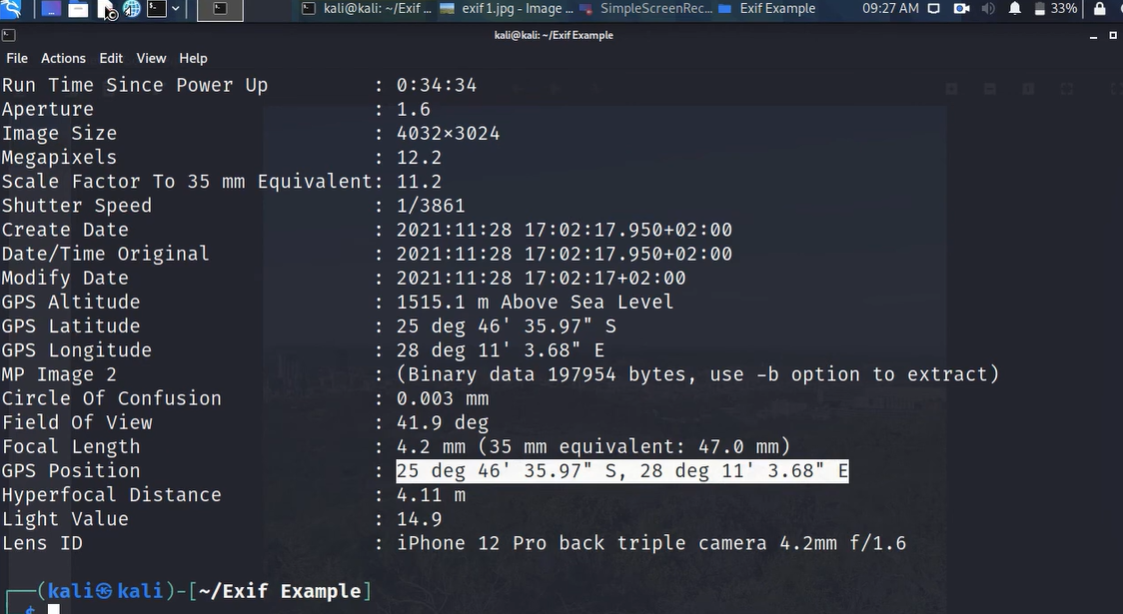
- Look for GPS Latitude and GPS Longitude in the output.
Use Desktop Software (Windows/Mac)
Some desktop software can extract and display GPS coordinates from image metadata. These tools offer advanced features beyond built-in OS options. Adobe Bridge provides a user-friendly interface, while ExifTool is a powerful open-source solution. Both help access location data while ensuring privacy compliance.
Adobe Bridge
Adobe Bridge is a professional-grade tool for managing images. It allows users to view EXIF metadata, including GPS coordinates. Adobe ensures compliance with GDPR and CCPA by giving users control over personal data.
- Open Adobe Bridge and locate the image.
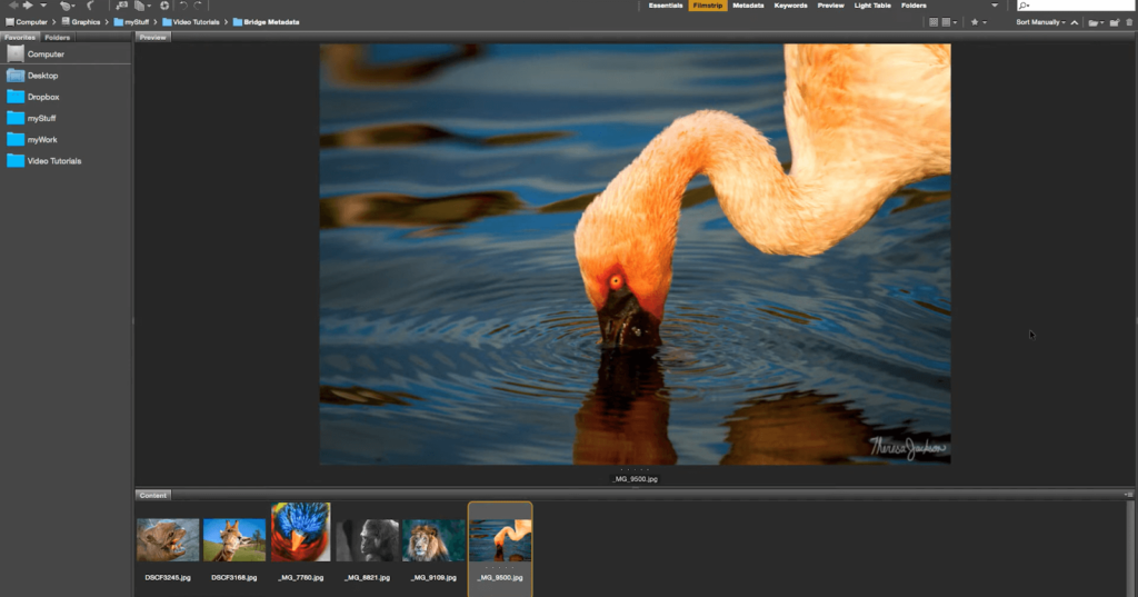
- Select the image and click File Info.
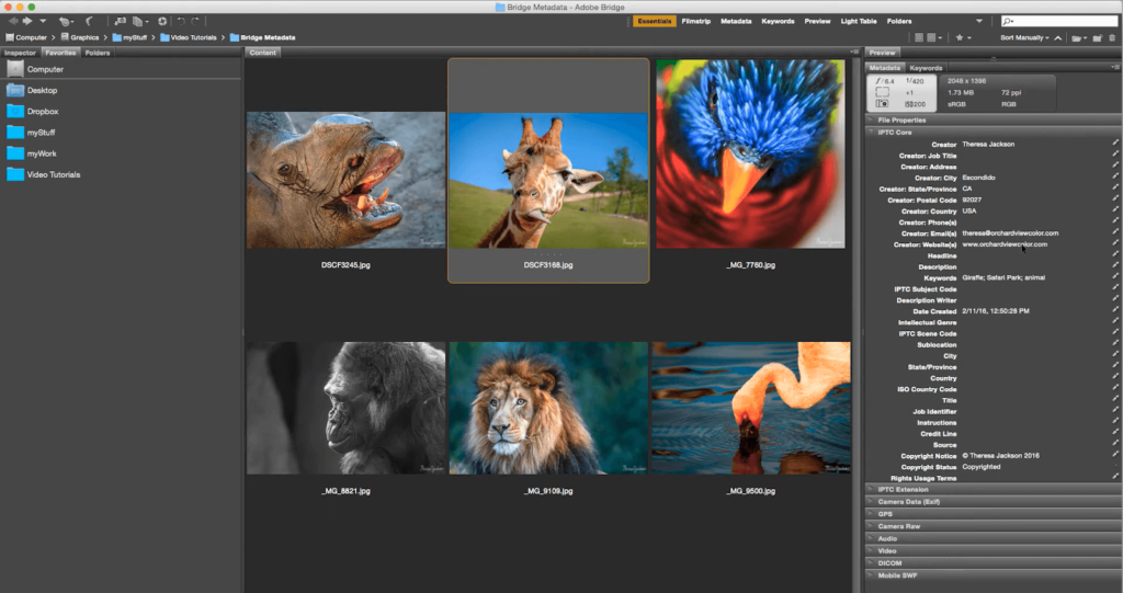
- Go to the Camera Data or GPS section.
- View the latitude and longitude coordinates.
ExifTool (Open Source Solutions)
ExifTool is a free, open-source command-line tool for extracting and modifying metadata. It provides detailed EXIF data, including GPS location, and works on Windows, Mac, and Linux.
- Download and install ExifTool from the official website.

- Open Command Prompt (Windows) or Terminal (Mac).

- Type: exiftool image.jpg.
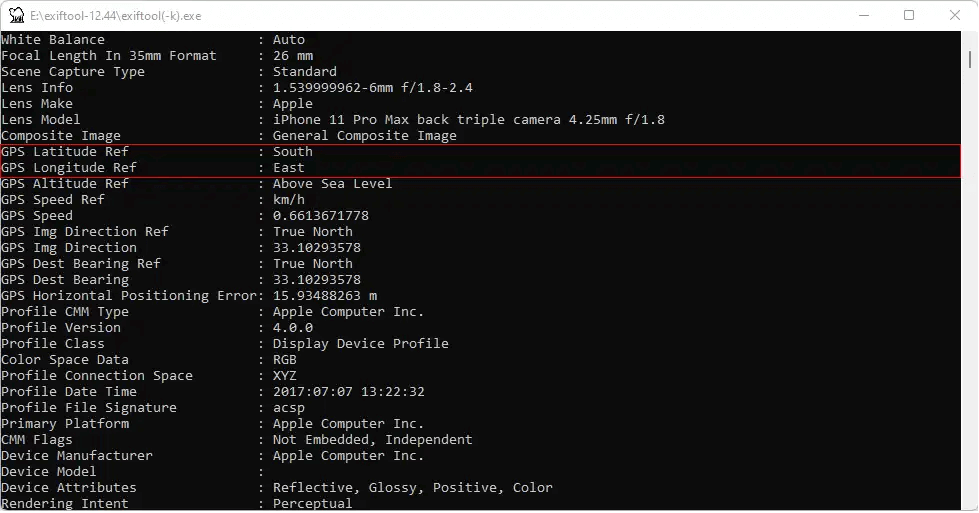
- Look for GPS Latitude and GPS Longitude in the output.
Use Mobile Apps
The GPS coordinates can easily be extracted from the images on your phone with mobile apps. Photo Exif Editor (Android) & Metapho (iOS) let a user view and later edit image metadata, including location information. They offer a simple way of getting geotagged data on the go.
iOS: Metapho
Metapho is a privacy-friendly app for iPhone that allows users to view and modify image metadata, including GPS coordinates. It ensures compliance with Apple’s privacy policies while giving users the option of erasing location data if necessary.
- Install Metapho from the App Store.
- Open the app and select the image.
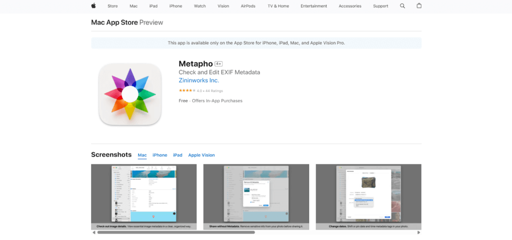
- Tap Metadata and go to the GPS section.
- View the latitude and longitude of the photo.
Android: Photo Exif Editor
Photo Exif Editor is an Android app that displays and edits EXIF metadata, including GPS coordinates. Users can check the locations of photos and even modify or erase location data.
- Download Photo Exif Editor from Google Play.
- Open the app and load the image.

- Tap EXIF Data and locate the GPS section.
- View the latitude and longitude of the image.
Use Online Tools
Need to find where a photo was taken? Online tools like GeoImgr and Pic2Map make it easy to geotag images or extract location data. Discover how these tools help with photo mapping.
GeoImgr
GeoImgr is an online tool for geotagging photos by adding or modifying GPS coordinates. It supports JPG, PNG, and WebP formats, allowing users to upload images, view existing geotags, and manually enter latitude and longitude. It ensures privacy by regularly deleting uploaded images.
- Upload your image.
- View existing geotags on the map.

- Move the marker or enter coordinates manually.
- Add extra EXIF data if needed.
Pic2Map
Pic2Map is an online photo location viewer that displays a photo and extracts GPS coordinates from a photo’s EXIF data. Image location is displayed on a map, together with other metadata like date, time, and camera settings. It serves as an EXIF viewer even without GPS data.
- Upload your photo.
- The tool extracts GPS coordinates.
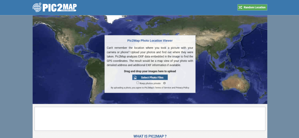
- View the image’s location on a map.
- Check additional metadata like camera details.
GeoCords
GeoCords is an online tool that allows any user to extract geolocation data from images. Secondly, it reads EXIF metadata to get the latitude, longitude, and GPS coordinates of pictures. Users can also do reverse geocoding, IP tracking, and a location search.
- Upload a JPG, PNG, or GIF image.
- Click “Get Geolocation” to extract GPS data.
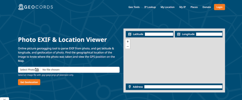
- View the photo location on a map.
- Access additional camera and EXIF details.
Picarta
Picarta uses AI-powered image geolocation to determine where a photo was taken. It analyzes images and provides GPS coordinates even if no EXIF data is available. The tool is useful for exploration, research, and verification purposes.
- Upload a photo or paste a link.
- AI processes the image for location data.
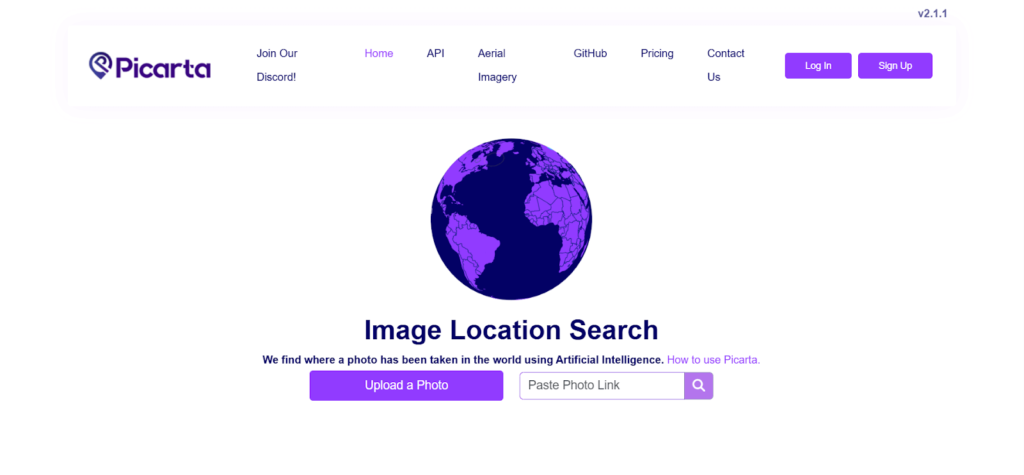
- View estimated coordinates and map details.
- Access additional metadata if available.
FAQs
How to find coordinates from a picture?
You can check a photo’s coordinates using Windows, Mac, Linux, mobile apps, or online tools. Simply view the photo properties or use tools like ExifTool, Metapho, or GeoImgr to extract latitude and longitude from the image’s metadata.
Can iPhone photos show coordinates?
Yes, iPhone photos store GPS coordinates in metadata if location services are enabled. You can check this by opening the Photos app, selecting an image, and tapping the Info (i) icon. Apps like Metapho also reveal detailed location data.
How to see metadata on a photo on an iPhone?
Open the Photos app, select the image, and tap the Info (i) icon. This displays metadata like date, camera settings, and location.
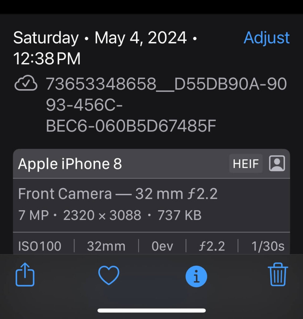
For detailed data, use third-party apps like Metapho or upload the image to an EXIF viewer.
Does photo metadata show location?
Yes, if geotagging was enabled when the photo was taken. Metadata contains latitude, longitude, and altitude. However, some platforms remove location data for privacy. Use tools like ExifTool, Metapho, or Pic2Map to check if location data is present.
Wrap Up
Finding latitude and longitude from an image is simple. You can use built-in tools, desktop software, mobile apps, or online tools. However, be mindful of privacy risks when sharing photos. If you want to remove location data, use apps like ExifTool or Metapho. Always check metadata before uploading images online to protect your personal information.


